Blog Local History
Oregon Trail history in Clackamas County: The Barlow Road story
By Lisa Hinkle, Realtor · · 6 min read
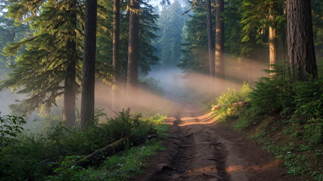
When people hear "Oregon Trail," they picture covered wagons crossing the Great Plains or fording rivers in the high desert. But the trail's final chapter happened right here in Clackamas County. The last 80 miles of the Oregon Trail — the Barlow Road — crossed through the very communities where I help people buy and sell homes today: Sandy, Estacada, and the surrounding foothills of Mount Hood.
I have always loved this part of local history. It speaks to the determination and resilience that still defines this area. And the best part? You can still see traces of the trail today. Let me take you on the journey.
By the mid-1840s, tens of thousands of emigrants had made the grueling overland journey to the Oregon Country. But the final stretch was a problem. The Columbia River Gorge — the last leg of the trail — was treacherous. Wagons had to be dismantled and floated down the river on rafts, a dangerous process that claimed lives and destroyed property.
Enter Samuel K. Barlow, a Kentucky farmer and wagon train leader who arrived in The Dalles in 1845. Denied passage on the Columbia, he decided to find an overland route around the south side of Mount Hood. With his party of about 20 wagons, he blazed a road through the rugged Cascade foothills and reached Oregon City that winter. The following year, he secured a charter to operate the road as a toll route, and the Barlow Road was born.
From 1846 through the early 1900s, more than 50,000 pioneers traveled the Barlow Road. It became the preferred final leg of the Oregon Trail, and it passed right through what is now Clackamas County.
If you have ever driven Highway 26 from Sandy up toward Government Camp, you have basically followed the Barlow Road. The route ran roughly parallel to what is now US 26, winding through the communities of Sandy, Brightwood, Wemme, Welches, Zigzag, Rhododendron, and Government Camp before crossing the summit and descending toward Oregon City.
After the pioneers crossed the Cascade summit near Government Camp, they faced the notorious descent down Laurel Hill — a steep, forested slope so treacherous that travelers had to chain their wagons to trees and lower them with ropes. Wagon ruts from this descent are still visible today, a tangible connection to the people who passed through here nearly 180 years ago.
From there, the road wound down toward Eagle Creek and the Philip Foster Farm, which served as a vital supply stop and rest point for emigrants making their final push to Oregon City. The trail then followed the route of modern-day Highway 224 into Oregon City, the official end of the Oregon Trail.
One of the things I love about living and working in Clackamas County is that pioneer history is still present in the landscape. If you know where to look, you can walk in the footsteps of the emigrants. Here are some of the key sites worth visiting:
Just north of Estacada, this 640-acre land claim is on the National Register of Historic Places. Philip Foster arrived in Oregon in 1843 and established a farm, store, and toll collection point for the final stretch of the Barlow Road. The barn, built in 1874, is one of the oldest standing structures in Clackamas County. The farm is open to the public with costumed interpreters who bring the pioneer experience to life. It is a wonderful place to bring kids and give them a sense of what life was like for the families who settled this area.
This Clackamas County park preserves about 1.5 miles of walking trails through old-growth forest on the historic Barlow Road route. It is a quiet, contemplative place where you can hike the actual path that pioneers walked. The forest here looks much as it did in the 1840s, with towering Douglas firs, cedars, and the soft carpet of moss and ferns that defines the Pacific Northwest.
This is the site of the infamous descent that terrified emigrants. Original wagon ruts are still visible in the bedrock, gouged by iron-rimmed wheels sliding down a slope so steep that pioneers had to double-lock their wagon wheels and use ropes to lower them safely. One emigrant wrote in 1852 that he "would rather cross the plains again than go down that hill." Today, standing at the site, you can look at those ruts and feel the weight of the journey.
A commemorative marker at Sandy City Hall notes the Barlow Road's route through the Sandy area. It is a small reminder that the pioneers passed through what is now downtown Sandy, a town that grew from a simple stopping point into a thriving mountain gateway community.
A replica of one of the five toll gates that operated on the Barlow Road from 1846 to 1915. The toll was $5 per wagon and 10 cents per animal. It is a good reminder that the pioneers were not just adventurers — they were practical people paying for infrastructure along the way.
It is easy to romanticize the Oregon Trail, but the reality was brutally hard. The emigrants who traveled the Barlow Road had already walked or ridden 2,000 miles from Missouri or Iowa. They had crossed the Rocky Mountains, endured the high desert of eastern Oregon, and lost loved ones along the way — disease, accidents, and exhaustion claimed many lives.
By the time they reached the Barlow Road, they were exhausted, malnourished, and running low on supplies. The road itself was rough and steep, a 19th-century dirt track through dense forest. Wagons broke. Oxen died. Families arrived at the Philip Foster Farm with nothing left but hope.
And yet they kept coming. Year after year, they came because they believed in the promise of Oregon — free land, a fresh start, a new way of living. That same spirit of starting over is something I see in my clients every day. People moving to Estacada, Sandy, and the surrounding areas are looking for a fresh start, a different pace of life, a place to put down roots. Some things never change.
The Sandy Museum and the Mt. Hood Cultural Center & Museum in Government Camp both have excellent exhibits about the Barlow Road and pioneer history. They are listed on the Mt. Hood Territory Heritage Trail, a self-guided route through the area's historic sites. Start at the Sandy Museum, drive the historic route, and end at the Philip Foster Farm. It makes for a perfect day trip.
What strikes me most about this history is how it shaped the communities I serve today. Sandy began as a rest stop for pioneers on the Barlow Road, a place to rest and resupply before the final push to Oregon City. Estacada grew later, built on timber and the railroad, but it sits within the same landscape that the pioneers crossed. The Eagle Creek area, where the Philip Foster Farm still stands, remains one of the most beautiful corners of Clackamas County.
When I help a client find a home in these areas, I often think about the layers of history beneath our feet. The road you drive to work, the trail you hike on the weekend, the park where your kids play — they are all connected to the story of people who came here looking for a better life. That is a powerful thing to be part of.
I share this history because I believe knowing where you live deepens the experience of living there. When you understand that the Barlow Road ran through what is now Sandy, you start to see the town differently. You realize that the pioneers chose this route for the same reasons people choose this area today: the beauty of the landscape, the resources of the forest and river, and the promise of a life built on your own terms.
Whether you are a first-time buyer looking for your first home, a family relocating to the area, or someone planning a fresh start after a big life change, you are part of that same story. The details are different — instead of a covered wagon, you have a moving truck; instead of a land claim, you have a mortgage — but the spirit is the same. You are building a new life, and I am here to help you do it.
So the next time you drive through Sandy, or hike near Rhododendron, or picnic at Barlow Wayside Park, take a moment to appreciate the people who came before. They traveled thousands of miles to reach this place. They saw the same mountains, the same rivers, the same tall trees. And they knew, just as you will, that this corner of Oregon is worth the journey.
Stay tuned for more stories about the places that make Clackamas County special. And if you are thinking about making this area your home, let me be your guide.
The Barlow Road brought more than 50,000 pioneers through Clackamas County on the final leg of the Oregon Trail. Historic sites like the Philip Foster Farm, Barlow Wayside Park, and Laurel Hill are still here for you to visit. The same landscape that drew pioneers in the 1840s draws homebuyers today. That is a legacy worth knowing.
Thinking of moving to Clackamas County?
From the historic Barlow Road corridor to the quiet rural properties of Estacada, I know this area inside and out.
Get in TouchWhether you are buying, selling, or just exploring your options, I am here to help you make the most educated decision possible.